
Since I became interested in backpacking, I’ve followed and read about the adventures of backpacking legend Andrew Skurka. He was named National Geographic’s Adventurer of the Year for his 6,875 Mile Great Western Loop, and he has pioneered some of the most adventurous backpacking routes in the U.S. Among the best of these is the Wind River High Route, a 97-mile world-class route traversing some of the most remote and rugged wilderness in the lower 48. I’ve wanted to do it for a long time, and a couple of months ago, I got a chance to make it happen.
Route Background
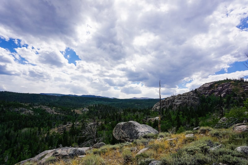
The Wind River High Route is a conceptual backpacking route, roughly following the Continental Divide through the heart of the Wind River Range in Wyoming. The main goal of any version of the route is to be a concentration of “best-of” features, usually staying as high as possible without requiring any technical climbing equipment. It’s extremely adventurous, remaining mostly off-trail and requiring navigation and route-finding skills to stay safe (which is also part of the fun).
There are several versions of the route (with none considered “official”), but to my knowledge, the most ambitious route is the one developed by Andrew Skurka. It’s 97-miles of pure alpine adventure, hitting three peaks, nine alpine passes, dozens of lakes, and passing by (or crossing) multiple glaciers.
It was appealing to me for a few reasons. First, it’s incredibly remote. Despite being world-class in terms of scenery and ruggedness, the Winds are pretty underdeveloped and not all that well known. Compared to the Sierras, there are very few access points, and the few trails that do exist are significantly less developed.
The second is that it’s incredibly difficult. I love a challenge, and although I probably wasn’t quite prepared enough physically, the high difficulty level is a huge part of what drew me in.
The third is that it’s beautiful. We have some incredible granite features in the Idaho Selkirk Range where we live, but the massive granite walls and peaks of the Winds are really only rivaled by those in Yosemite (within the continental U.S.). The difference in the Winds is that there are far fewer people, giving it a wilder feel that I’m very much into.
Trip Overview
I had seven days to complete the route. For Skurka, that’s plenty of time. For mere mortals, however, it’s a pretty ambitious timeline. It’s only an average of fewer than 14 miles per day, but as Skurka says, vertical elevation change (and the amount of off-trail travel) is a lot more relevant to pacing than overall mileage on a high route. On the WRHR, the vertical change is an astounding 620 vertical feet per mile (the fairly rugged John Muir/Nüümü Poyo Trail, which we completed last year, is only 425 vertical feet per mile, and entirely on-trail). And that’s if you pick the best line, a skill that comes only with off-trail experience (of which I had little).
Having never attempted something like this, I didn’t really know where my limits would be. So I budgeted seven days (the max I could get off work, plus travel days), prepared the best I could, and figured I could use alternates if necessary to save time. That certainly wasn’t the goal, but it ended up being necessary a couple of times (for multiple reasons). I’m still happy with the result, and I was able to complete it as a thru-hike, hitting the full mileage but coming nowhere near fulfilling the whole route. I guess that just means I’ll have to go back.
I bought Skurka's guide (which includes a mapset, waypoints, and descriptions of route features; found here) to help with planning. Because the guide is written from south to north, I decided to go northbound to make the flow easy. My brother helped me out, and we dropped my truck at the northern trailhead (Trail Lakes, outside of Dubois, WY), and he took me to the southern trailhead (Bruce Bridge, outside of Lander, WY).
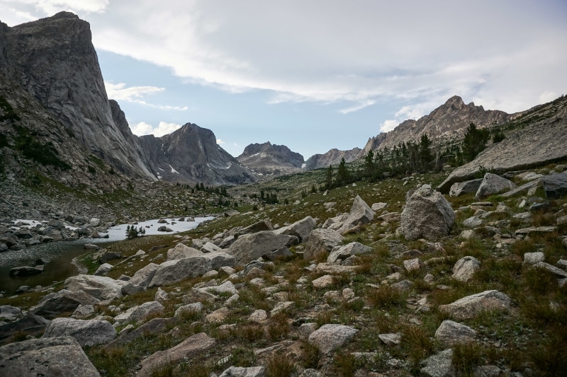
Day 1: The Popo Agie River
The first 12 miles of the trip are all on-trail, serving to help with acclimation and getting used to hiking. Because of the way our schedule worked out, I didn’t get started until about 2:30, which I figured was fine because It should have been relatively easy walking.
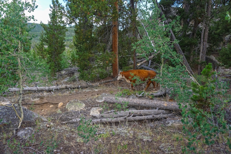
Unfortunately, the altitude, lack of sleep the previous night (4 hours?), and heavy pack (due to 7 days of food + bear canister) were not kind to me. I live at 2000 feet and had no acclimation time, so I didn’t move as fast as I thought I would. It was a nice walk, though, and I was treated to the company of dozens of mooing cows that graze in the area. I set up camp on a bench 9 miles in at about 9600 feet, made some food, and prepped to climb Wind River Peak the following day.
Day 2: Wind River Peak
The second day was intense. I broke camp around 8 AM and started moving toward Wind River Peak, the southernmost 13er of the Wind River Range. Slowly the forested area that I had camped in gave way to more alpine scenery, including open meadows and Deep Creek Lakes, before popping out onto the broad, ramp-like ascent to the peak.
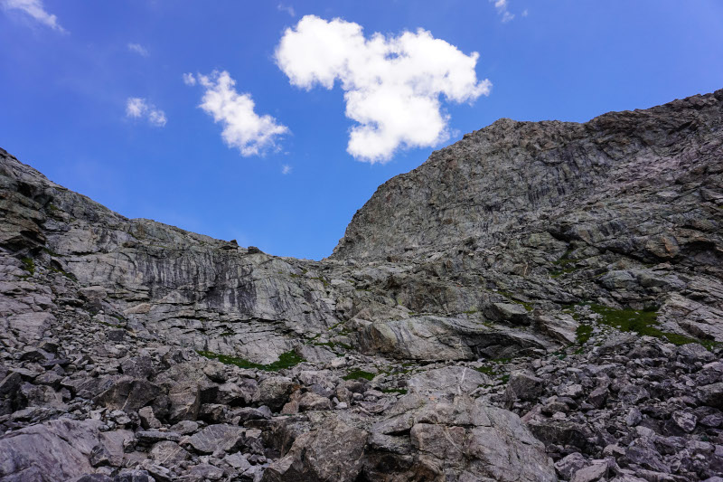
It was a good intro to the off-trail alpine environment because although it’s steep and hard, it’s easy navigation and mostly just a physical grind. It took me longer than I would have liked to get to the saddle between Chimney Rock and the peak (≈ 12,600 feet), and the last 500 feet of ascent dragged on because of the absolutely punishing wind. I’d forgotten how bad the wind can be in the alpine (though I suppose I should have figured, given the name of the range), and this was some of the most difficult I’ve ever experienced. It was an always-have-two-points-of-contact kind of wind, the kind that will knock you over if you happen to be standing on only one foot when it gusts. Me and two other high-routers stopped to take shelter several times on the way to the top and didn’t complete the ascent until about 3:00.
Luckily the weather was good (i.e. no storms) so I sat in a little cove in the rocks to have a snack and take in the massive views. I also prepared myself for the downright scary descent off the peak.
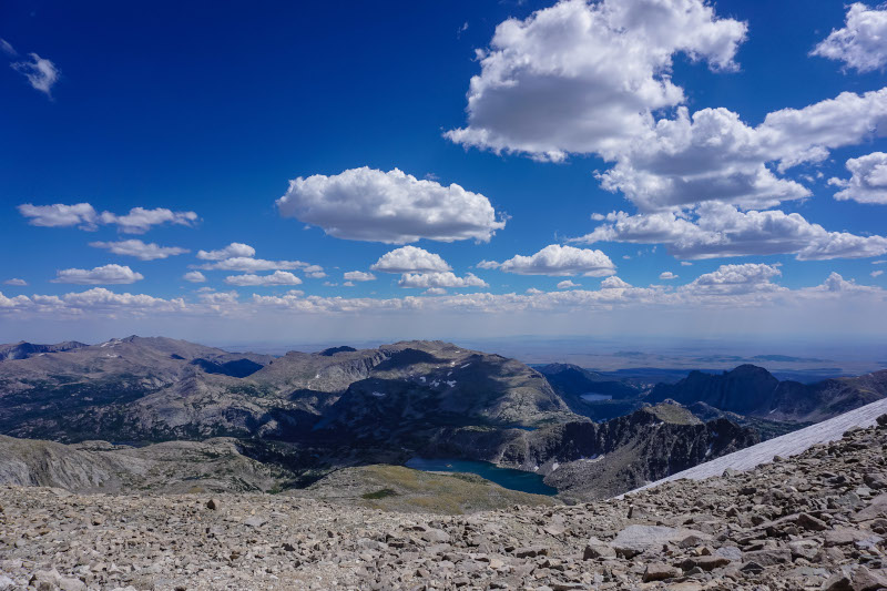
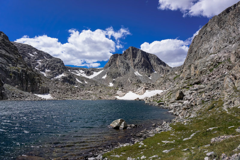
Skurka describes the “West Gully” as the most formidable feature on the route, and though I wasn’t able to hit some of the other more challenging features, it was far and away the scariest section I encountered. It’s long, steep, and requires crossing mixed gravel, scree, and talus above high cliffs to get to the more straightforward (though still steep) descent toward lake 11185. It was not fun, and I don’t think I’d ever been happier to be on relatively flat ground by the time I reached the bottom. On the way down, I made my first mistake of the trip, slipping and hurting my left hand (I assumed it was sprained at first, though I’m pretty sure now that it was broken). This was ultimately part of the reason I had to skip some features, which I’ll get into later. The descent took hours, and I finally got to the northwest end of lake 11185 around 6:00 pm, exhausted and ready to call it a day. I traveled a little further down Black Joe Creek and camped at a near-perfect spot on the small lake just upstream from Black Joe Lake.
If I was to do it again I might take the prescribed alternate, the Coon Lake bypass. It’s significantly longer and kind of circuitous, but still stays very high and would probably be very enjoyable. I really enjoyed the route following Black Joe Creek towards Big Sandy Lake, though, which is completely bypassed when taking the Coon Lake route. It’s playground-like and makes for really pleasant walking.
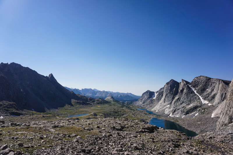
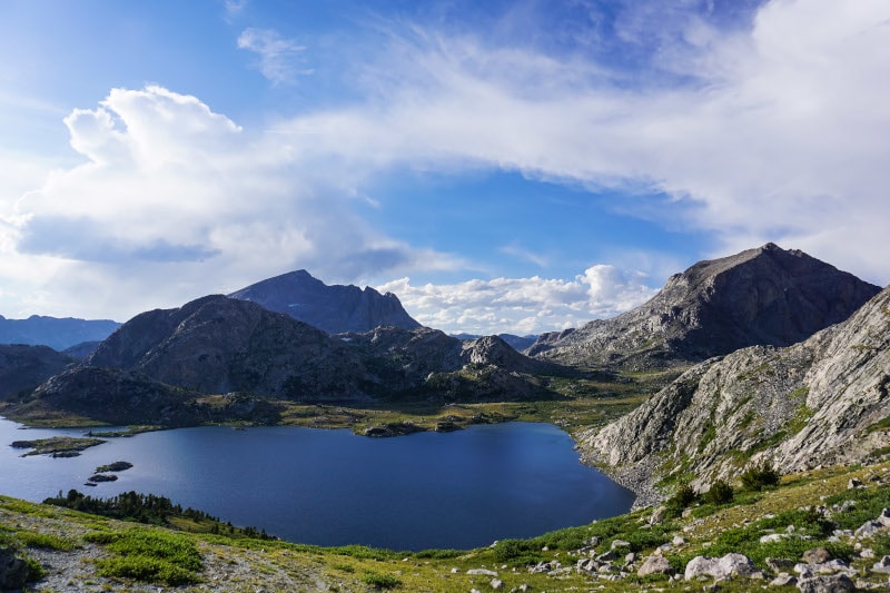
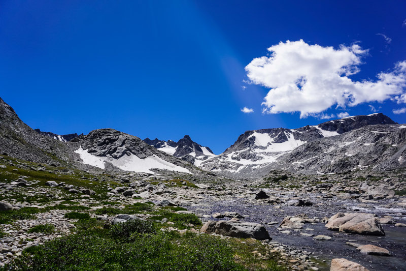
Day 3: Cirque of the Towers
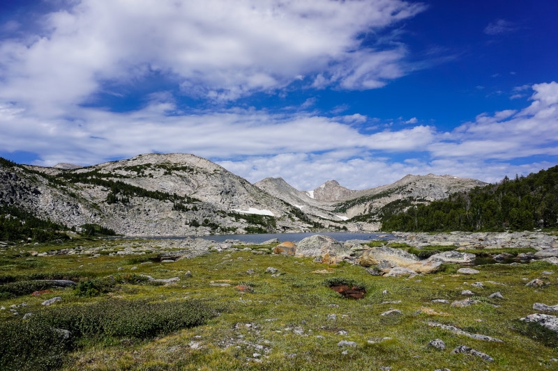
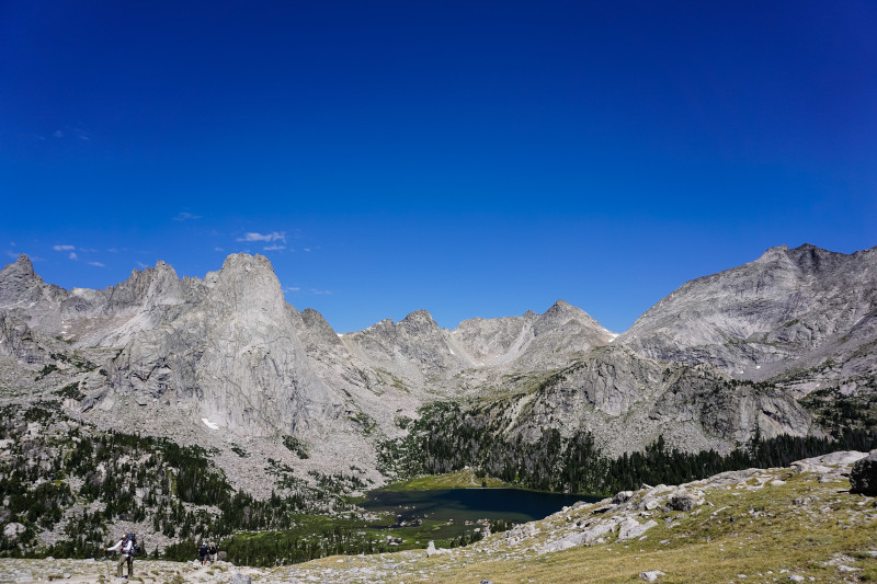
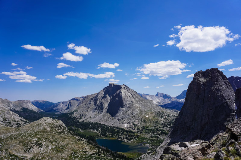
The scenery of Day 3 is what initially got me interested in the route, and it didn’t disappoint. I woke up and followed Black Joe Creek/Black Joe Lake (a perfect morning walk) to Big Sandy Lake, where the route uses an established trail to go up and over Jackass Pass into the Cirque of the Towers.
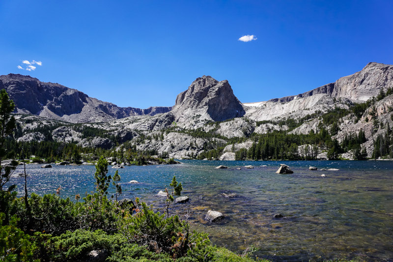
The Cirque of the Towers is one of the most popular areas in the Winds (and a popular CDT alternate) for good reason. It's an absolutely stunning collection of massive granite walls encircling the idyllic Lonesome Lake, a couldn’t-be-more-perfect place for camping if camping was allowed (it’s restricted within a ¼ mile of the lake). This section alone makes the trip worth it, and I highly recommend it as a standalone loop hike if that’s all you have time for. The visual highlight of the Cirque is the massive Pingora Peak, a rock climber favorite. It juts straight up nearly 2000 vertical feet above the lake, and it literally took my breath away (could’ve been the altitude also, but I’ll chalk it up to the view) when I topped Jackass Pass and it came into full view.
The other highlight of the cirque for me was New York Pass. Texas Pass is the more common exit from the Cirque because it has a trail, but New York Pass is a hell of a lot more fun. It involves ascending intermingled talus and open grass up to a high ledge that takes you straight to the top. It’s a tough climb, but super fun and rewarding. It looks a little daunting from the bottom, but I loved it and it ended up being a lot less sketchy than it seemed. I would highly recommend it to anyone doing the route.
The descent from New York Pass was also great, with easy tundra walking giving way to a mostly stable rock/dirt chute. It dumps you out at Billy’s lake, where you hook up with the Washakie Pass trail and head downhill before turning back uphill at Skull Lake, following the East Fork River up toward Raid Peak. When I turned and got a view of the valley, there was a massive thunderstorm brewing (which turned out to be a theme of the trip) and I had to stop and wait in the lower elevations for it to pass (while multiple groups of climbers hastily passed me in the opposite direction). Luckily the storm changed directions and moved directly south, opening up the relieving post-storm sky and allowing me to make a move up the valley around 6pm.
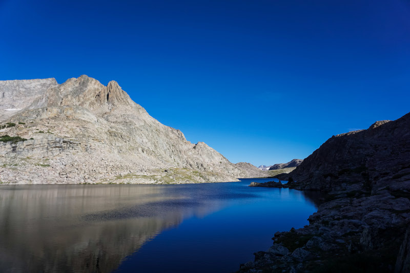
The travel up this valley is probably the best I experienced anywhere on the route. You get to stroll through wide-open park-like spruce forests, huge granite slabs, flat gravel plains, and grassy ramps created by old moraines. Travel in these glacial valleys is blissful, and it’s made even better by the long line of granite walls that rise 2000 feet above. I was able to get a couple more miles in after the dinner I had during the thunderstorm and camped in a protected dip in the rocks at the second to last lake in the valley (≈ 10,400 ft).
Day 4: Bonneville Basin
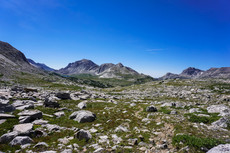
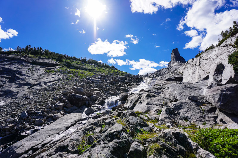
Day 4 began early, with an immediate ascent to Raid Peak Pass. Most of the ascent was great, following the open grassy ramps up through the upper basin. At around 11,000 feet it becomes talus-hopping, which I found to be pretty tedious. It wasn’t difficult, just slow-going and not particularly enjoyable.
This was also the point where the altitude started to take its toll. Thankfully, I have never had issues with full-on altitude sickness, but it functions as a severe appetite suppressant for me. Eating quickly became a chore, if not semi-uncomfortable (chocolate and potato chips didn’t even sound good), which is a huge handicap on a trip as intense as the WRHR. I had to fight to maintain energy levels, and it was apparent that I wasn’t eating nearly enough. I knew this would happen to some degree, so I brought half a bag of Tailwind drink mix that would give me some easily consumable calories to get me through tougher sections. It wasn’t really enough, though, and the effects of having no appetite only worsened as the trip went on.
I was happy to get to the top, and even more pleased to follow a slabby class 3 route down to Bonneville Basin. You have to be more careful with these kinds of descents, but I find them to be a lot more fun than talus walking and the time flies.
It was here, though, that I noticed another major issue; my left hand was more or less entirely out of commission. I could use my trekking pole with wrist-strap mostly without issue, but it helps a lot to have hands when following steep slabs, and I couldn’t use my left hand nearly as much as I would have liked. It didn’t become an issue navigating the Raid Peak Pass descent, but it made me worried about the upcoming class 3 ascent of Europe Peak.
I made it down to Bonneville Basin, choked down a bar and some jerky, and started up Sentry Peak Pass. My low-energy aside, I thought it was a really fun ascent. It’s grass mixed with slabs, and it is well-used enough that there are steps cut into the sections of steep dirt. I took the zig-zaggy route up the right side, which meant I had to rock hop the final 50 vertical feet or so. Looking back I think the left side might’ve been better, but I was still pretty happy with my route choice.
The descent from Sentry Peak Pass was another super fun one. It was supremely slabby until I hit a snowfield, which I was able to boot ski down and come out onto tundra interspersed with rocks. As I descended, another storm began brewing to my left, and by the time I hit the southern end of Lee Lake it was raining. Rain quickly turned to pelting hail, and I took shelter under a clump of trees at the northern end of Lee Lake. The precip let up after ten minutes and I started moving again, but about halfway along the shore of Middle Fork Lake the thunder started, and it was loud and close.
I hunkered down among the trees on the shore of Middle Fork Lake, where I had to make a decision. Wait out the storm and then try to ascend Photo Pass in the late afternoon, or take the Halls Lake Low route to keep moving. I ultimately opted for the low route, because the storm didn’t seem to be letting up and I was zapped. I had been looking forward to Photo Pass, but my low-energy and the fact that I was already behind on pace made it a pretty easy decision.
I continued West from Middle Fork Lake and turned back North toward Halls Lake. It was, as Skurka accurately describes, “ho-hum”. It involved a fair amount of willow whacking, winding around vegetated knolls, and generally picking my way through stunted forest to get there. You can't see very far (the vegetation was tight enough that I startled another group of hikers who thought I was a bear in my black rain jacket), and the knolls can make it hard to stay moving in one direction, so it's a compass-out-at-all-times situation. I still had light, so I continued on from Halls Lake toward Europe Canyon trail and camped just off the trail on the North end of lake 10542 (about a mile from the pass). It was a great campsite, with some protection and a big open meadow. It was nice to relax a little, but even after a hard day eating my hot Mountain House was tough with no appetite.
Day 5: Low Routes/Alternates
Right off the bat at the start of Day 5, I had another decision to make. The North Fork Boulder Creek low route is another prescribed alternate which begins right where I camped, and bypasses Europe Peak (the summit of which is on the primary route). Europe Peak is listed on tons of trip reports as a highlight of the route, but it involves some class 3 scrambling and requires using handholds and a little bit of athletic maneuvering. It sounded super fun and I had been looking forward to it, but my hand was in bad shape and I was worried about getting up there and finding that I would be unable to safely make the climb. If I got up there and found I couldn’t do it, I wasn’t sure that there would be a way around the summit that would efficiently and safely put me back on the route (which is an amazing opportunity to ridge-walk straight down the Continental Divide).
I ultimately decided to take the Boulder Creek low route. This decision alone is enough for me to be already planning a redemption trip, because I feel like I missed out big time. The low route wasn’t unenjoyable, and I got to do a little bit of scrambling along the shores of lake 10683. But on the whole it was pretty monotonous, and I can’t wait to get back to summit Europe Peak.
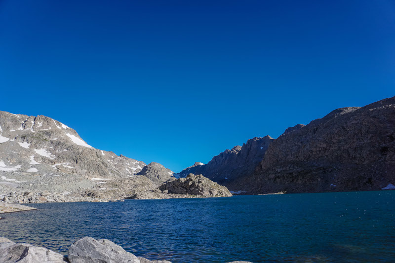
The low route goes over the Continental Divide at Hay Pass (just under 11,000 feet, barely a pass by WRHR standards), which is mellow and pretty. The pass trail ends up at Golden Lakes, an idyllic little oasis tucked in a deep valley. I wish I had the opportunity to camp there, but I arrived around noon and made it an extended lunch stop instead.
There is a “trail” leading from Golden Lakes towards Camp Lake, but it’s rough. It’s one of those trails where you can see it obviously on the ground, but in many places it’s totally overgrown with willows and krumholtz branches. It was a pain to get through, but there really isn’t another good way around. It doesn’t last that long, though, and I made it back into the alpine fairly quickly.
Once I popped out with a view of the upcoming Douglas Peak Pass, I was hit by the punishing wind again. I was warned about it by hikers coming down and hoped it wouldn’t be as bad as it was on Wind River Peak, but it was as bad if not worse. There were also mounting rain clouds as I worked toward lake 10787, creating an ominous feeling knowing I had a particularly gnarly 11,800 foot pass just ahead. I sat by the lake for a few minutes and decided on taking another low route, the Camp Lake low route. It’s a nice walk (Alan Dixon puts this section on the primary route in his iteration of the WRHR, and I ran into a group there who was following it) and offered some protection from the brewing storm. I don’t know if the storm that looked to be brewing ever materialized over the pass, but switching up the route left me with sunny skies and an opportunity to climb back up into Alpine Lakes Basin from the east side.
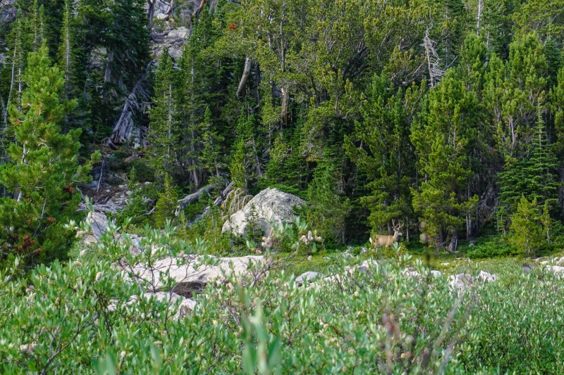
I picked a horrible route up from Camp Lake and got stuck willow whacking through a swampy braided stream. I got rewarded for it, though, and saw an enormous mule deer buck in velvet at close range. This was my first major animal sighting (not including cows) so I was really excited about it. After that the travel got better, and I followed a tight finger ridge up into the basin. A good chunk of that was walking straight up the slabs that line the creek and it’s waterfalls, which was enough to make my route choice worth the willows.
The wind was once again punishing at the edge of the basin, so I backtracked a little and found a flat spot among the rocks that was semi-protected. It was only about 6:00 when I set up camp, but I knew from the guide that Alpine Lakes would be unforgiving, and with that much wind I would rather camp protected than get in another couple of miles. It was a loud night, but I got some good rest before my most difficult day.
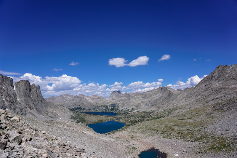
Day 6: High Passes and Glacial Streams
I have mixed feelings about my day 6. It was one half amazing, one half absolutely brutal.
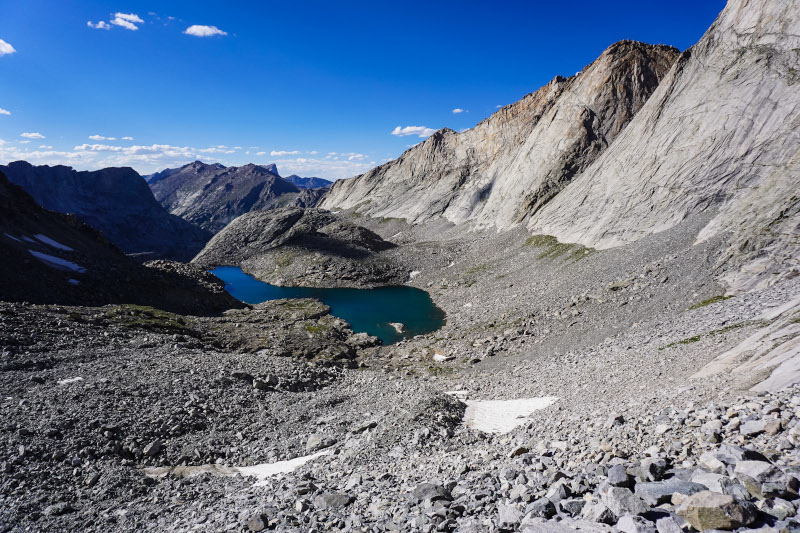
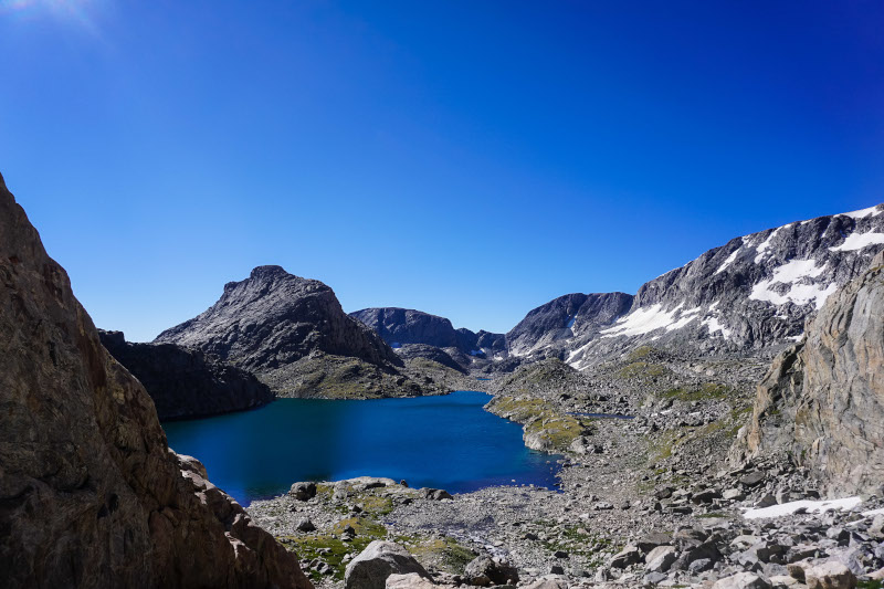
It started with brutal. I woke up early and immediately started working my way into Alpine Lakes. This involved climbing a couple hundred feet to get around to the south side of lake 10895. Looking at the map and at the features in front of me, I wasn’t sure I could trust Skurka’s route notes that said the North side of the lake was traversable, so I opted for the surefire way through. Looking at it from the other side, I still didn’t see a way around that wouldn’t have been as difficult or more so than the way I took around the south side. It was fairly easy travel to get to the lake, but the easy travel stopped there.
At the lake, the travel turns into endless talus hopping. It’s relatively big talus, too, so it’s more like picking your way through than casual rock hopping. It continues around the West side of the lake, north and uphill to the next lake, all the way around that lake, and partially uphill toward the third and final lake in the basin. I got a little bit of relief there, following a grassy ramp up, but where it leveled out the rock hopping began again. Then there were bluffs along the shore of the last lake that had to be circumvented, and while I acknowledge that it was my fault for not picking the best way around, this part sucked. I got stuck 300 feet above the lake, picking my way down zig-zagging mini-cliffs to get back onto the talus. I think it took me about an hour to go a half mile, if that tells you how rough the terrain is.
Finally, after hours of less than ideal travel, I was gifted a couple of snowfields that allowed me to grind to the top of Alpine Lakes Pass. I don’t think I’ve ever been so thankful to be kicking steps into near-vertical snow, and the pure physicality of it was a huge relief from the non-stop rock picking of the previous three miles. I made it to the top around noon, almost five hours after starting only 4.5 miles back.
I took a rest break at the top to try to eat and talk with a couple of guys who had been following just behind me the whole trip (“This might be a weird question, but can I see the bottom of your shoes? ... I knew it, we’ve been following you the whole way!”). I hung out up there for about a half-hour, but my big plans for the day got me moving again. Next up: Blaurock Pass, the steepest climb on the whole route.
The travel going north from Alpine Lakes Pass is the exact opposite of that to the south; that is to say absolutely blissful. It’s hard-packed gravel, long smooth snowfields, even tundra, and flat glacial floodplains. The creeks are glacially fed, so they’re milky blue with silt (a completely unique and awesome thing for me) and you get to walk through and along the sandy floodplains of these creeks for a long time. Aside from the mounting bad weather and the fact that I knew I had a tough climb ahead, this was some of my favorite travel on the route (maybe even made Alpine Lakes worth it?).
The bliss ends at the floodplain of North Fork Bull Lake Creek around 10,900 feet, and the climb begins. It’s the steepest climb on the route, gaining 1200 vertical feet per mile from 10,800 feet to 12,800 feet. The first 600 vertical feet or so of the climb were steep, but not difficult because it’s solid tundra. Easy walking, just a grind. Then the talus hopping started and it became very tedious. I got a little break from it by following some lingering snow further into the valley, but I didn’t gain much elevation that way.

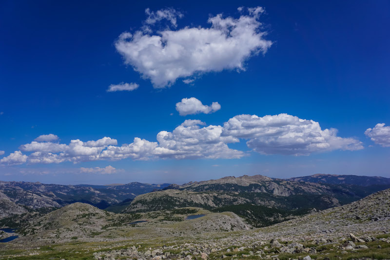
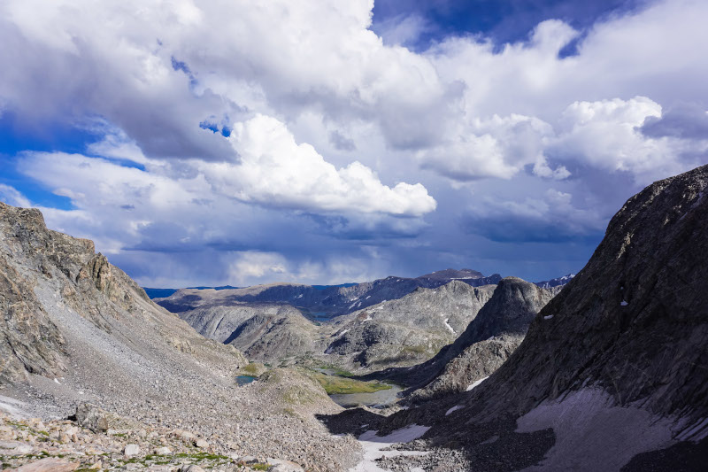
At the same time, there were massive storm clouds brewing just above me. I figured I could always run back down to safety if necessary, but I needed to make my miles, so I went for it. As I got higher up I began to see the weather pattern that was saving me from getting destroyed by the storm. To the west of the aptly named Turret Peak, the afternoon storm clouds were moving directly east, on a path to drop torrential rain right on top of me. But due to some lucky feature of the topography of that ridgeline, the clouds split right at Turret Peak. The storm clouds turned there and were sent southeast, and to the northeast (and my direction of travel) harmless, wispy white clouds were all that was left. My view was imperfect, but I watched cloud after cloud get split by the peak and behave this way. And as I gained elevation I could see that to the south, there were heavy storms for miles and miles, while to my north, I could only see blue sky.
I continued on up through the talus, and just as I was about to reach hard-packed dirt and gravel, I was treated to the sight of a bighorn sheep standing on a finger ridge across from me. It gracefully dropped down the ridge in front of me and was followed by a whole group, including little ones. It reminded me that this isn’t that hard, and gave me a little burst of mental fuel to grind to the top. So much so that I actually overshot, climbing high to the left instead of to the low gap in the snow to the right. I contoured around and below the snow and emerged at the top of the pass around 5:00 pm.
Here I knew that my trip was mostly done. It was the end of day 6, and with only one day left there was no way I had time to fulfill the whole route. The rest of the primary route from Dinwoody Creek (2 miles from Blaurock Pass) is 25 miles long and has nearly 15,000 feet of vertical change (including an ascent of Downs Mountain, the Northernmost 13er in the range). For me it would have been two full days of hiking at best, and completely exposed. I had food for three or four more days of hiking (due to my debilitating lack of appetite from the previous days), but just didn’t have the time, or frankly, the energy. The Glacier Trail, which crosses the route at Dinwoody Creek, would have to be my exit.
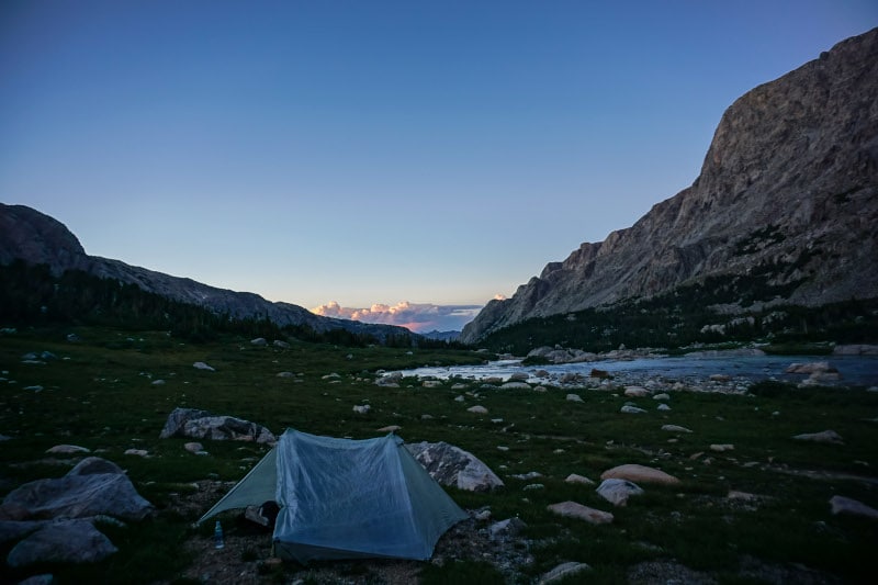
I followed a nice use trail down from the pass, which gave way to a little bit of slabby downclimbing and then to tundra. It was a knee-pounding descent, but a fairly easy one, and I was grateful for the downhill. I crossed Dinwoody creek, hiked a mile or so in the waning light to the treeline, and set up my last campsite next to the creek with great views of the glaciers and Gannett behind me. My legs were worked, and in the effort and discomfort of walking around doing camp chores, I knew that taking the Glacier Trail out was the right decision. Again, though, I knew I’d have to make a plan to come back. Crossing glaciers, topping Downs mountain, and strolling atop the Continental Divide were things I’d miss, and things worth making the trip back for.
Day 7: Glacier Trail and Exit
I don’t have a lot to say about Day 7, other than that it was long. The Glacier Trail, for much of its length, is a beautiful walk. It stays alongside Dinwoody Creek for a long time, which eventually becomes a very large, glacial river that is a treat to walk by. Then it transitions back uphill to several beautiful lakes, which under different circumstances would have made amazing campsites.
Beyond that, the trail becomes exposed again on high plains, which makes for easy but very monotonous, seemingly never-ending walking. Then it drops again, switchbacking over and over (and over) again 2000 feet into Bomber Basin. The trail here is dry and dusty, and after walking nearly 24-26 miles that day (my phone tracking didn't agree with my Garmin tracking), I couldn’t have been happier to see my truck in the distance. My feet were worked, having pushed my La Sportiva Bushido II's beyond their comfort limit (though I love the shoe; check out my full review here). I stretched out a bit, slugged water that I had stashed in the truck, and began the long drive home.
Conclusion
Overall the Wind River High Route was a complicated experience for me. It was unlike anything I’ve ever done, and unrivaled in natural beauty and pure grandeur. I don’t expect I’ll ever experience anything like it (until I get the chance to go back).
It was also thoroughly grueling. Every day was a challenge, one that I was not altogether prepared for. I love to push my limits, and I’m proud of what I accomplished, but being better prepared physically would have helped me tremendously. This isn’t a trip where you can skimp on fitness and still enjoy it to the fullest. It’s extremely hard physically and mentally. Every mile is more difficult than anything you’ll find on established thru-hiking trails anywhere else in the country. And even with significant changes to make the route easier, it’s far and away the most challenging hike I’ve ever done. But now I consider it unfinished business, which isn’t necessarily a bad thing to have.
My training included 10-15 mile mountain runs with similar elevation gain and loss, but that wasn’t nearly enough. I’ll need to prep with a heavy pack, and ideally have a little time to acclimate to the elevation before jumping in headfirst. I could probably have brought and used more Tailwind (or similar endurance drink) also. And going solo for 7 days, I realized fully the morale benefit that a partner and teammate (ahem, Alyssa) can bring. The challenge was doubled by the solitude, and next time I’ll see if I can rope someone in to go with me.
That’s all I have for the trip report. I’ll post a gear list here soon, but I probably won’t post a food plan because I wasn’t happy with mine. It was thrown together fairly last-minute with food from Grocery Outlet, and while I generally like everything I brought, I definitely should have been more strategic. My appetite issues meant I had to choke down even the best of my food, so next time I’ll bring only the best (AKA goldfish, potato chips, and peanut MnMs). The big win was Tailwind, which was invaluable to me as a booster for tough sections.
Have any questions or thoughts? Let me know in the comments and I’d be more than happy to chat and answer them.